

The Prairie States Forestry Program (PSFP) was initiated in 1935 to combat severe soil erosion from the Dust Bowl years. Over the course of the next 7 years, the U.S. Forest Service, working with the Works Progress Administration and the Civilian Conservation Corps, planted nearly 220 million seedlings in the Great Plains. These plantings, known as windbreaks or shelterbelts, created 18,600 miles of linear strips of trees from North Dakota through Texas (Williams 2005). Windbreaks play an important role on the landscape in the plains region. These linear plantings of trees and shrubs are designed to enhance crop production, protect structures and livestock, and benefit soil and water conservation (Figure 1). Windbreaks also provide habitat for wildlife and pollinators, sequester carbon, provide income opportunities and enhance aesthetics.
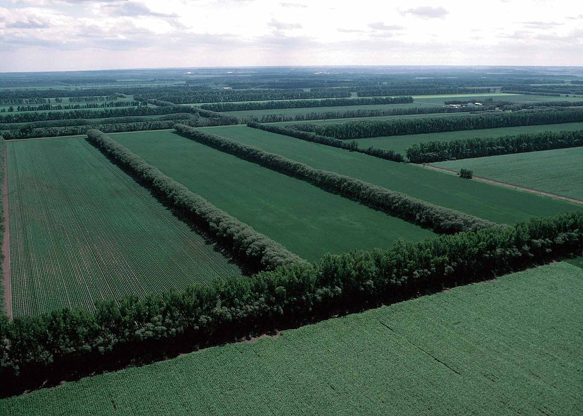 Figure 1. An example of field windbreaks in an agricultural setting. Source: USDA National Agroforestry Center
Anecdotal evidence suggests that windbreaks are being removed due to a variety of factors including age-related decline, modern farming practices, and crop prices. Yet no coordinated, permanent, recurring monitoring program exists for trees used in agroforestry in the U.S. This limits information available to decision makers, resource managers, and land planners. The USDA has formally recognized the need to inventory and monitor agroforestry systems such as alley cropping, silvopasture, forest farming, riparian forest buffers, and windbreaks (USDA Agroforestry Strategic Framework 2011). The lack of information about these windbreaks limits the inclusion of important contributions of these important tree resources into state, regional, and national assessments. There is no baseline information needed for wise decision-making in the sustainable management of these systems in the face of changing conditions.
The USDA National Agroforestry Center (NAC) (Lincoln, NE) and the U.S. Forest Service’s Forest Inventory and Analysis (FIA) program at the Northern Research Station (St. Paul, MN) have partnered to develop a monitoring program for these resources in the central United States. One such effort, aimed at building a historical baseline for windbreaks, is bringing old information into the digital age. Original PSFP maps, photos, and other relevant information that have been housed at NAC are being inventoried, digitized, and scanned. Old hand-drawn legal land description maps that show original windbreak plantings are being digitized using GIS technology, allowing for a baseline inventory of the original windbreaks, which can be viewed using current aerial photography. In one example from Antelope County in Northeast Nebraska, original plantings were compared to 2010 aerial photography (Figure 2). Analysis found that 38% of the original windbreak locations were still intact, with 40% partially intact and 22% no longer in existence.
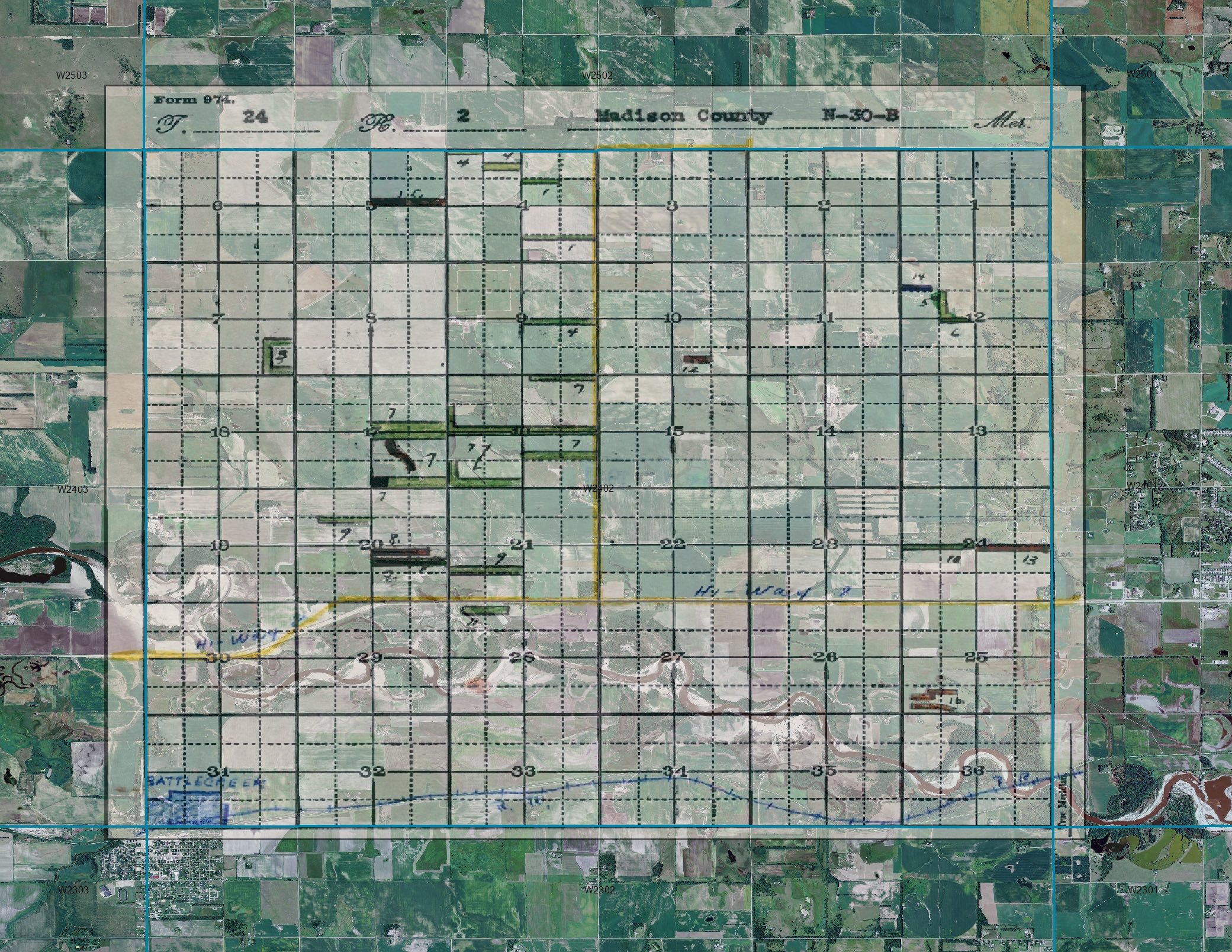 Figure 2. An old paper map showing original windbreak locations overlaid on current aerial imagery using GIS. Source: USDA National Agroforestry Center
Information about species, landowners, tree spacing, growth and other interesting tidbits give some insight into the vast PSFP work. Bringing this information forward in a usable, digital format helps tell the story about windbreaks and trees in the Great Plains in general (Figure 3).
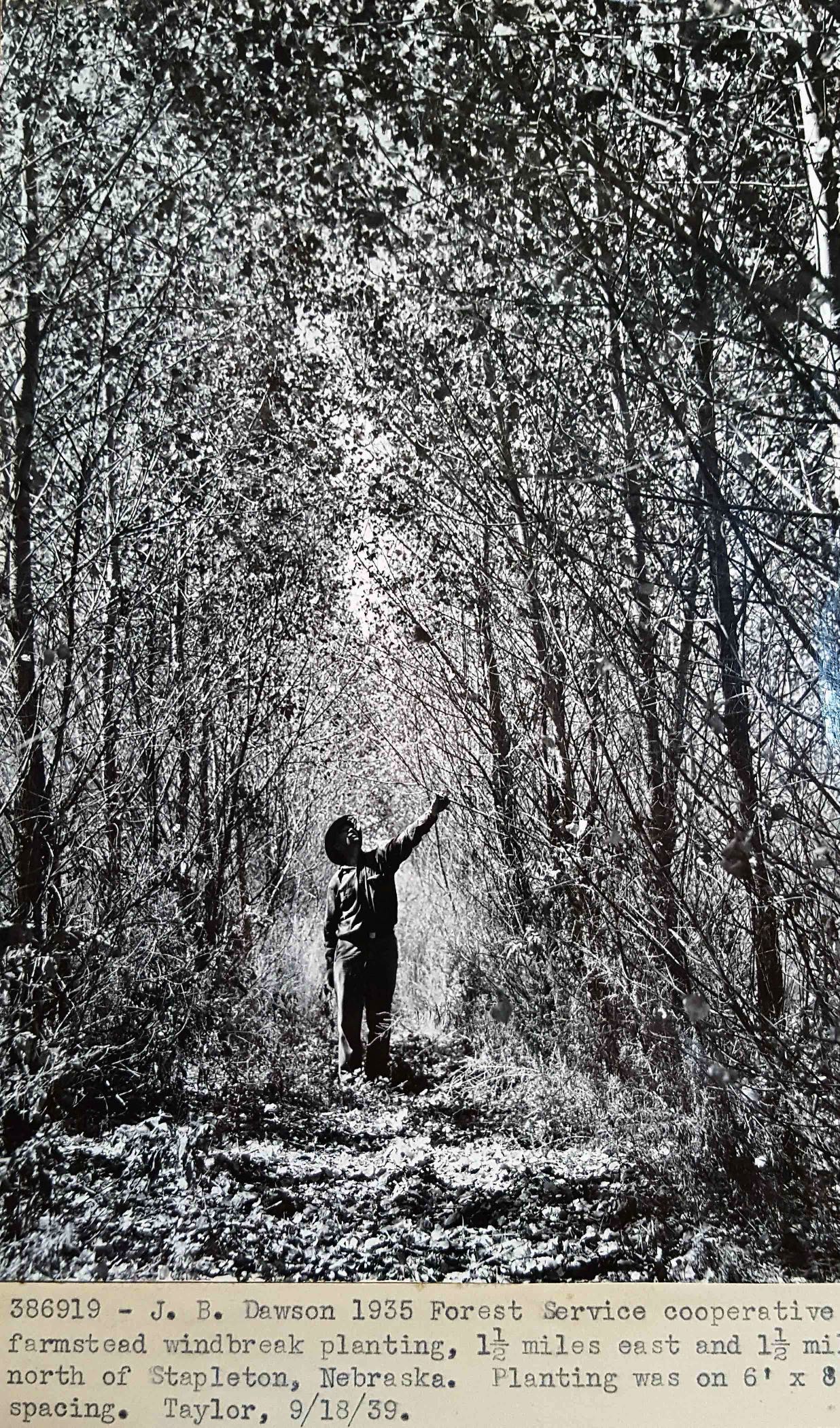 Figure 3. Example of old photographs being digitally archived. Source: USDA National Agroforestry Center
In an effort to provide current, spatially-rich information about trees in the central Plains States, NAC and FIA are also developing maps based on high-resolution aerial photography. The work is ongoing in conjunction with partners at North Dakota Forest Service, South Dakota Conservation and Forestry, University of Nebraska-Lincoln, Kansas Forest Service, and Texas A&M Forest Service. An example of a complete map dataset for Kansas can be found at the U.S. Forest Service Research Data Archive.
The Prairie States Forestry Program was one of the largest conservation efforts ever in the U.S. President Roosevelt’s “Great Wall of Trees” was and is still an unprecedented federal effort with local buy-in that planted trees on mostly private lands. Preserving this rich history and using current technology to meet current information demands will help ensure these important resources are being counted and can be managed into the future.
References
USDA (United States Department of Agriculture) (2011) USDA agroforestry strategic framework, fiscal year 2011–2016 – enriching our lives with trees that work. http://www.usda.gov/documents/AFStratFrame_FINAL-lr_6–3–11.pdf. Accessed 01 December 2017.
Williams, Gerald W. (2005) The USDA Forest Service—The First Century. USDA Forest Service, Washington, DC.